Completed Tagteam Cycling Routes


WHERE WE HAVE BEEN. The colored lines on this map represent where we have tagteam cycled since 1 Aug 2015. BLUE lines = 2015, YELLOW lines = 2016, RED lines = 2017. We will continue to update this map as we complete additional route segments (we are not done yet!).

Sunday, July 31, 2016

Day 127: Trail of Tears State Park, MO

In my last post I noted how much Alea had enjoyed riding the other day.  I've noticed that I've also been finding the riding a lot more enjoyable, and I suspect a big reason is that we are now riding toward the sun every morning, and the winds tend to favor traveling eastward (the latter was certainly my experience back in 1985 when I crossed the continent).


One thing that has occurred, due to all this heat and humidity, is that we have been finding ourselves getting off the road a bit too early each day (in order to avoid riding in the worst of the heat).  That leaves us with a lot of time on our hands, and with weather that isn't conducive to very many activities.  And if we are in a cell reception dead zone, it can make for a long, boring and uncomfortable afternoon.  Especially since it is WAY too hot to be leaving Lana in the van for more than a few minutes at a time without leaving the air conditioner running.  That nixes most tourist activities that could otherwise get us indoors for an hour or two.

Thus we have decided, unless we have a lot more than 50 miles to cover in a day, to return to our spring and fall routine of lingering a bit at our campsite in the morning before heading out.  That also puts us riding in the extreme heat for another hour or so during the day, but it leaves us with fewer hours to pass at our campsite in the oppressive heat, waiting for a thunderstorm to rumble through to cool things off, or for the sun to dip far enough on the horizon.

So what that means for today's ride is that it was the first day where I experienced a few hours with a heat index near or above 100 degrees.  The result was major leg cramping toward the end of my 50 miles, in spite of washing down as much Gatorade as I could handle, plus downing a banana and various snack food.  I suspect my body will adapt to the new stress soon enough, that it was just a bit of a shock to the system today.  With Alea's riding pace, she has already had a few such days over the past two weeks, so our schedule change isn't as likely to affect her as much.

So we've learned at least two things so far on this trip: 1) we will forever avoid cycling most of the northeastern United States (at least within a hundred miles or so of the Atlantic Coast), and 2) when we travel coast to coast in the future we will choose a trajectory more to the north of where we currently are, opting to head through the mountains where possible when we again need to head south toward Georgia or Florida.

I finished today's ride in downtown Cape Girardeau, MO.  From there we loaded everything in the van and drove to Trail of Tears  State Park, where we are camped for the night ($21, power, vault toilets, community water and there are showers down the road a ways).  We have a view of the Mississippi River, where we see barges passing by fairly often.  We also have a view of the train tracks.  The trains move fairly slow and thus aren't too noisy, but there is a crossing gate not far away so they blare their horn as they approach it (that is very obnoxious).  I'm not optimistic that the train traffic will decrease in the evening, as this a major freight corridor.  But we'll only be here one night, and this will be our last night in Missouri.

The one interesting thing that occurred on the road today was that I found a baby possum walking along the shoulder of the highway.  I stopped to get a picture of it, and soon discovered why it happened to be there: mom had been killed in the middle of the road.  I went over to investigate and found another baby crawling over her, and a few others who were suckling, trying to get that last meal that she had left for them.  It was a pretty sad sight, and no doubt within a few hours those little ones were snacks for a fox, coon or similar predator (provided that they did not get run over, in which case the vultures and crows would be doing the clean up).


We bought a collapsible bucket today, in order to deal with our lack of a water pump with which to access our on-board water supply.  At 1.3 gallons, it gives us adequate water for cleaning up after cooking.  And it is light enough that we can carry it and our 3 gallon Igloo water cooler to the hydrant at the same time.  To keep unwanted things from getting into the water in the bucket, we cover it with our cutting board.  And if we need to put the hatch down, we place the bucket in the sink.  It's a simple enough solution until we can affect a repair to the pump (which likely needs to be replaced).

Day 126: Silver Mines Recreation Area, MO

Alea's 50 mile ride yesterday went very well.  Being Saturday, we had hoped that truck traffic would be nearly non-existent on the first third of the ride, but that wasn't the case.  There was a steady parade of dump trucks traveling in both directions, but they were courteous and only passed when it was clear there was no oncoming traffic.  


The next third of her ride was among some of the best cycling terrain we've seen in the past year, and the road surface was in great shape.  Alea was loving it, and she was thinking it would be more of the same for the rest of the ride into Frederickstown, MO.  But Mother Nature sent her reminder: you are still in the Ozarks!  Fortunately that reminder was mainly in the form of one long, steep grade, but with some other shorter steep grades tossed in for good measure.

I gave this little guy a lift across the road, to keep him from getting squished...
When we reached town Alea was finally able to find something she had been seeking for the past two weeks: a root beer float.  A lot of the franchise fast food and dairy places don't have them on the menu.  It's generally the locally owned places or A&Ws where they are found, and it has taken this long to find the former.

We camped at Riverside Campground at Silver Mines Recreation Area ($18, power only, vault toilets, communal water).  It was a nice enough place, and the campground hosts were very friendly.  The humidity dropped somewhat below 50% and the highs weren't much above the mid-80s, so it was comfortable enough to stay outside all afternoon.  We can only hope that we'll have a few more of those days before it heats up again.

It looks as though the water pump in our camper has given up the ghost.  We'll need to contact the factory to see if there are any obvious things that we haven't checked to get it back up and running, or if it will be necessary for them to send us a replacement.  Right now we are in the market for a collapsible water carrier, as we need an efficient means of getting additional water when we are in where we only have access to a communal water supply.

Saturday, July 30, 2016

Day 125: Lesterville, MO

It was a fairly uneventful day riding the 55 miles to Lesterville, MO.  The AM temperature was only 66 when we awoke, and had reached a very pleasant 70 by the time I started riding.  About half of the ride was on recently paved roads with very low traffic volumes.  The remainder was on busier roads with no shoulders, but I was fortunate that overtaking traffic never tried to pass me when there was oncoming traffic.


The temperature spiked around 11 am after the clouds finally broke, but it wasn't much more than 80 degrees when I stopped riding around noon.  But from then on, the temperature and humidity both increased considerably.  Fortunately, an afternoon rain shower came through and cooled things off for us, so it was quite pleasant in the evening.

We are camping at Twin Rivers Campground ($35, power, water and showers).  It is nice enough for a private park, and the owners certainly seemed friendly enough.  The campground was fairly deserted when we arrived, but there has been a steady parade of campers all afternoon and well into the night.  I suspect they don't have many vacant campsites left, if any.

Lana is enjoying herself here, as the river is close by.  She can romp in the shallow water without fear of upsetting any anglers.

Thursday, July 28, 2016

Days 123 & 124: Montauk State Park, MO

Alea had a nice, short day's ride of 32 miles to get here yesterday.  Most of it was with a wide shoulder (except the last few miles with no shoulder), before we stopped at a crossroads, piled her bike in the van and drove to the campground.

One of the Montauk Springs.
We are camped at Montauk State Park ($23, power [50 amp] and showers) for two nights.  We could have saved $2 per night in a 30 amp site, but then the bathrooms would have been twice as far away.  We figure it is worth the extra $2 even though we can't use the extra power.


We opted to stay here two nights to hopefully get things timed right for the weekend.  We know that we will need to stay at private campgrounds the next two nights, and generally getting a campsite on a Friday or Saturday does not present the same sort of problems in a private campground that we sometimes encounter in public campgrounds (they aren't as likely to fill up).  So by Sunday, when we start hitting public campgrounds again, we should be able to get in without making reservations.

In stark contrast to last night's campground, this place is absolutely packed.  We just barely managed to get the last first come, first served campsite with power, though there were a few primitive sites still available.  But with the heat and humidity, power is essential to being able to sleep well at night.

At least the weather has been nice enough that Lana gets to play in the river from time to time, and we were able to see Montauk Spring and explore the park a bit.

The big attraction her at the park is the fact that they stock the river with trout.  So they have large fish rearing ponds here, which we were able to inspect up close.  Lana was quite perplexed, having never seen water so densely packed with fish before.  And when we tossed in some fish food (they have dispensers for just that purpose), she was quite intrigued by the fish jumping out of the water in their attempt to get to the food before it was gone.  


Wednesday, July 27, 2016

Day 122: Maramec Spring Park, MO

The next few days we will be creating our own route in order to get back to a portion of the Great Rivers South route that we bypassed last fall.  Fortunately, the Missouri DOT has maps of various categories of traffic volumes, plus an overlay of sections of roadway with a four foot or wider shoulder.  So it was fairly easy to cobble together a route to Rolla, MO that worked great for us, with the exception of the last mile or so into Rolla.

We had a bit longer day than either of us likes to ride, so we once again split the mileage.  I did the first 37 and Alea took over for the final 25 miles.  My section was rolling hills and pleasant temperatures.  Alea's became roller coaster hills, highs in the mid-to-upper 80s and a brief but fairly heavy rain shower.

Just before getting to Rolla, her chain came off on the outside of the big chainring in front.  So I doubled back to help out.  I wished I had taken a picture, because it was seriously bunged up, but it wasn't long before it was straightened out and she was back on her way.  I was just thankful that it didn't snap off the rear derailleur.

Once we got to Rolla we found a bike shop to make certain the front derailleur was adjusted properly and we wouldn't have a repeat of this incident.  We replaced her brake pads at the same time, as there weren't that many miles left on them, especially since were are back in the Ozarks, so there will be no shortage of steep hills.  While she and Lana waited for the bike repairs, I went off to shop for groceries.


When I returned we loaded up and went quite a ways off route to Maramec Springs Park, which Allstays had described as a state park.  It isn't, it is managed by some sort of foundation.  So our night's stay there with only power was $36!  Twice as expensive as our stay the previous three nights and only about half as nice.  It was no surprise that we were the only campers when we first arrived, though we did end up with one neighbor a short time later.  In hindsight, we would have been better off finding a private campground closer to our route.  


The shower house was one of the more rustic public facilities we've been in, and it had those damned MASH-style showers.  But we were amused at their unique solution to making certain that the toilets didn't run out of toilet paper: 


But the park itself was nice enough - crystal clear spring water for Lana to romp in and cool off from the heat, and a couple of huge herds of deer in the adjacent meadow.  But between the heat and the showers we didn't have that much ability to enjoy the surroundings.

Monday, July 25, 2016

Day 121: Missouri State Archives

We are still at Binder State Park.  I spent the morning at the State Archives looking at old deeds, with only a little success.  My Missouri ancestors seem to have chosen to live in counties where courthouses tended to burn down shortly after they had lived there.

One of those counties was Washington County, which in 1823 included parts of several other counties.  One of the things that I found at the state archives was a court case in which my 3rd ggf Thomas McEveny was sued by John Gibson over a debt of a bit more than $20.  He borrowed that money in 1823 and the suit was filed in 1827.  The tiny bits of paper in the file are a bit cryptic, but it appears he was order to pay $17 to John Gibson.  

That loan was a little more than a year after Missouri was admitted to the Union.  It was also a couple of years before the birth of my 2nd ggm and his eldest daughter, Mariah Lucinda (McEveny) Wiggins.  

A Washington County marriage record for Thomas to his wife Elizabeth Van Anglen has not been found, but the fact that he was in Washington County well before Mariah's birth strongly suggests that was where he was married.  So while that is a tiny piece of information, it answers a question about whether or not they were married before getting to Missouri.  That still leaves the fate of Elizabeth's parents up in the air, but the best bet is that her father had been born in New Jersey and moved to Kentucky.  But that is only speculation, and I have no idea where to look in Kentucky for more information.  And I have no idea why she eventually ended up in Missouri.

Another interesting thing is that two years later, in 1829, Patrick McEveny filed suit in Washington County, Missouri.  At least one person thinks that Patrick was born in Ireland around 1785 and died in Washington County in 1846, but I can find no documentation for any of that.  I know that Thomas had an older brother named Daniel who was likely born around 1793.  I've never been able to find any record of him.  I've known about Patrick in Washington County for years now, and thought that he had showed up there well after Thomas had left.  It turns out that isn't the case - they were there around the same time.  So I suspect they were related.  And while it is possible that Patrick is a cousin from Ireland, the odds are probably a bit better that he was Thomas' older brother, who was called Daniel in his mother's probate file in Sheldon County, Vermont (Thomas' parents were Cornelius and Polly [Watson] McEveny, and they both died in Vermont around 1813).

Mariah Lucinda McEveny married Charles Augustus Wiggins in Clark County, Missouri in 1846.  Thomas McEveny is found there in the 1840 Census, and this past weekend I learned that in 1839 he was called up while living there to serve in the Missouri Militia over a border dispute between the State of Missouri and Iowa Territory.  It turns out that in 1840 he bought two lots in St Francisville for $125, selling them less than a year later for $250.  That tells me that he had some assets, and probably would have left some sort of an estate.

Unfortunately, by 1843 they were living across the river in Keokuk, Lee County, Iowa; yet another place where the courthouse burned down after he died there around 1856.  I have yet to get there to see if there is some sort of estate deed that names his heirs, so that is still on my to-do list.

That he had left money to his heirs is one possible explanation for some interesting deeds in Crawford County, Missouri (it is the county just east of Washington County).  It may be that Thomas McEveny had been living in the portion of Washington County that was included in Crawford County when it was formed in 1829.  If not, he was likely living fairly close to the eventual boundary between the two counties.

The first deed was executed by his son Samuel A. McEveny on 7 July 1856.  That property was sold the following year by his mother, who was acting as his guardian (suggesting he was not yet 21 years of age when he tried to sell the property).  It is interesting that he was able to purchase the property when he was under age, but could not sell it without his mother's consent.  Anyway, another deed was executed by Samuel a short time later, presumably to clear up the title so that it clearly showed that he consented to the sale.

A couple of years later, Thomas' widow received a patent for 40 acres in Crawford County.  But I've been unable to find when that property was later sold.  That deed would likely give me an idea of when she died (some time after 1860), and might identify all of her heirs.  Her second eldest daughter, Mary Ann, settled there with her husband (James Rogers Bowles) about the same time as Samuel.

Another of Thomas' sons, Thomas Fletcher McEveny, may have received a patent to a 320 acre property in Oregon County (a couple of counties further south) in 1859.  In it, he is described as "Thomas McAvinney of Washington County."  

It is also possible that this was Patrick's son and not Thomas'.  When the Civil War broke out, Thomas Fletcher and Samuel A. moved back to Keokuk and enlisted in the Union Army.  And there is a Thomas McAvinney who served in the Confederate Army for Missouri during the war.  So it is probably more likely he was Patrick's son.  The difference in the way the names were spelled is not at all unusual, as most names were spelled phonetically by the clerk who recorded the muster (or other public records).

So a few hours at the state archives has helped to fill in some gaps, but there are still many questions left unanswered.

Sunday, July 24, 2016

Days 119 & 120: Jefferson City, MO

It was Alea's turn to ride on Saturday, from McKittrick, MO to Jefferson, MO, a total distance of 44 miles.  We are certainly glad she got an early start and that it wasn't any farther, as by the time she reached Jefferson City it was 97 degrees out, with over 50% humidity.  And that was before noon!


A few of the trailheads provide tools and a tire pump!

With it being the weekend, we did see a fair number of other cyclists out on the trail, most riding the length of the trail from Clinton to Saint Charles.  If the temperatures had been cooler I suspect we would have seen many more folks out for shorter rides.


Standing Rock near Steedman, MO.  Located a mile and a half
from the Missouri River, it marks the level of several major floods.
Since it was Saturday (the busiest camping day of the week) we had our fingers crossed that there would be space available for us at a city campground located in Binder State Park.  They did, and it is definitely on our list of favorite campgrounds.  For $18 per night we have power and shared water.  The latter isn't too conveniently located on the site that we chose, and you need to bring your own hose splitter.  But it was close enough for us to easily top off our freshwater tank before setting up.  All of the sites have level concrete pads (most are well shaded by mature trees), grill, fire ring and a covered picnic table.  There is a laundry that costs $1 to wash and 50 cents to dry (the second best price we've found: the best was free).  And the bathhouse/laundry building is air conditioned!


On the down side, the shower temperature cannot be adjusted and they are operated by push button (but you get a full shower's worth of water on a single push), and the toilet paper is mounted on bars that don't allow the toilet rolls to spin.  But those are very minor inconveniences, especially given the great price.

There are only 16 sites here, so it is a well kept secret!

We had decided to add Jefferson City to our route in order for me to visit the state archives.  They have most, if not all, of the early county deed records on microfilm, so the plan is to learn more about my various ancestors who had lived in Missouri between roughly 1820 and 1870.

Missouri has a fair number of early records available online, and it has been quite a while since I last checked to see what was available.  I discovered that Thomas McEveny (a 3rd ggf) was enlisted in Captain Wm. McKee's Company of Missouri Militia in the Honey War, a bloodless dispute that took place in 1839 over the boundary between the State of Missouri and Iowa Territory.  He also was involved in a lawsuit in Washington County, Missouri in 1827, and I should be able to find the contents of that file when I visit the archives on Monday.  It may tell me nothing of interest, but with luck it will offer some more clues about him and his family.

Saturday, July 23, 2016

Day 118: Hermann, MO

We left Bev's house fairly early, once again hoping that an early start would get us down the road a ways before we ran into more oppressive heat.  It was in the 80s when we got up around 5:30, but the wind was blowing, signaling that another front was moving through.  Fortunately this time there wasn't much threat of severe weather, just rain and wind.


Bev sent us on our way with grilled egg, ham and cheese sandwiches (which were awesome).  We got back to the trailhead and were pleased to find that it was a few degrees cooler since it was closer to the river.  I got rolling at a fairly fast pace, hoping to get some miles in before it either rained or became uncomfortably hot.  I made it 23 miles to Marthasville before we decided to wait out the rain. 


The story about the Katy Trail.
It took almost three hours for the storm to pass, but when it did I was back on the road.  That particular section had only two trailheads, and included the longest segment of the Katy Trail between trailheads, 16.1 miles.  We stopped at McKittrick, loaded up the bike and headed across the river to Hermann, a very quaint and attractive town originally settled by German immigrants.  In all I rode 46 miles for the day.

A section of trail washed out by recent flooding.

We headed to Hermann City Park Campground ($25, power and water), being thankful to find an unreserved site with a bit of shade.

The showers here deserve a mention.  The shower house is like an oven, with very little ventilation and no fan.  The showers themselves are somewhat reminiscent of a MASH episode, in that they have no temperature control (becoming fairly warm, eventually) and are turned on by pulling a chain.  You have to continue to pull the chain for the water to keep running.  Visualize having a bar of soap in one hand and the chain in the other, and you can imagine the sorts of contortions that are required to get everything lathered up and rinsed off.  Which only makes you sweat that much more when you are attempting to get dried off afterward.


Due to the storm and the associated cloud cover, it didn't get as hot today as we were expecting (thankfully!).  We were actually able to sit outside for most of the day, though after taking the shower it was necessary to jump inside the camper with the AC for a while to get cooled back down.

Friday, July 22, 2016

Day 117: Lake St Louis, MO

By the time we reached downtown St Louis it was 6:30 am, sunny and 81 degrees out.  But there was very little traffic, which made it easy to get through what could have been a chaotic mess.  About an hour into Alea's ride the traffic started to build as we neared I-170, but then things calmed down once we were past that, and the same scenario repeated once we neared I-270.


As cities go, it was one of our less stressful urban experiences, due in large part to hitting the road before traffic had built up significantly.  We saw quite a bit along the way that we would have liked to have explored, but the high heat and humidity meant that we couldn't leave Lana alone in the van for more than a few minutes at a time.  In fact, our fuel mileage has dropped a couple tenths of a mile per gallon in the past few days, because whoever is driving needs to leave the engine idling quite a bit so that the air conditioner can keep them cool while they wait for the cyclist to catch up.


No telling why... 
But there is a large collection of locks adorning the bridge crossing the Missouri River.
Once Alea left St Louis and crossed the Missouri River, our route followed the Katy Trail, a cinder surfaced, converted rail line that now extends from St Louis to Kansas City.  She rode on the trail as far as Weldon Spring, MO, and her total mileage for the day was 41 miles.  When she finished riding around noon it was 91 degrees out and with humidity that easily exceeded 75%.  The heat index later that evening at 8 pm was 108.


There was some storm debris on the Katy Trail...
We spent the night at the home of Beverley (Malone) Lundak in Lake Saint Louis, my second cousin and the second closest cousin of my Malone line (I have only one closer Malone cousin, Linda Kaye Waltman, a first cousin, whom I've never met).  I met Beverley while researching my Malone book, and a few years ago she was kind enough to invite me, my mother and my Aunt Pat to her house to celebrate Pat's 95th birthday, something that Pat enjoyed to no end.  And I suspect Beverley enjoyed it just as much, as Pat was likely the only living family member who had a living memory of her grandfather, Clarence Lafayette Malone.  Clarence had lived just around the corner from Pat and my grandfather (Paul Edward Malone) when they lived in East Saint Louis, Illinois in the early 1920s.


Me, Alea and Bev.
Beverley lives with her granddaughter Nickie (sp?) and great grandson Jackson.  Plus there was Chico (a rather portly Chihuahua mix [I'd guess part rat terrier or something similar]) and Max, her 30 year old parrot.  We kept Lana and Chico apart, due to Lana's tendency to be a bit of a bossy pants around smaller dogs.  But that was fine, because Lana was totally engrossed by Max, who in turn was not at all intimidated by Lana's quivering stares.


"Pretty bird..."
It was amusing in the evening when Max got in a talkative mood.  Of course Lana has no clue where sound comes from (being deaf in her left ear), and the new voice had her quite perplexed.  Especially once Max started whistling, and even more so when I started whistling back to him.  They kept each other entertained for hours.


Staying the night in Bev's house marked the end of our streak of 174 straight nights sleeping in our camper.  We had planned to park outside her house, but the logistics were a bit impractical given the excessive heat, so we caved in and parked the van and camper across the street (we were not about to try to sleep in it without air conditioning).

Bev's hospitality was incredible, greeting us with a platter of fresh fruit and pitcher of iced tea, and with tacos and peach pie in the evening.  And of course plenty of dog treats for Lana.

It was great to have several hours to talk with her, sharing with her what has happened in our lives since the last time we met, and to learn a bit more about her family in return.

Wednesday, July 20, 2016

Day 116: Saint Louis, MO/Granite City, IL

We were up early today, thinking that we would beat the heat with an early start.  I started riding around 6:30 am, but only got about 5 miles down the road before we caught up to a thunderstorm that was being funneled toward St. Louis.  A couple of flashes of lightning struck near the trail I was riding on several miles in front of me, which prompted us to stop and wait things out.  That was a good decision, as it ended up raining for hours.  Despite the continuing rain, I'd  go a few more miles down the trail whenever it looked as though the lightning had moved on.  


We were waiting just south of Carlinville...

It seemed to be my day for wrong turns (I haven't had one of those in a while).  A good part of the ride was on trails, and those trails would get shunted off on to surface streets.  That's where I got crossed up, twice.  The first time, I was following a trail alongside some railroad tracks.  Then the trail disappeared.  Since it wasn't that far to where I would rendezvous with Alea, I bushwhacked a couple of miles of dirt road to get back on track (not so much fun with all the rain we had today).


The second time I made a wrong turn onto a new trail.  That ended up taking me seven miles out of the way, six of which was on a very wet cinder surface.


We finally reached Granite City, IL around noon, where we checked into the KOA ($45.50, power, water, cable, wi-fi, showers) - at least the shower rooms are air conditioned.  


A souvenir of the wet cinder paths...
After I got cleaned up from the soggy ride this morning, we unhitched the trailer and drove into St. Louis, where Alea dropped me off at the Gateway Arch.  Urban areas are always challenging for us, primarily because there aren't many places where you can park a van and camper that together are 30 feet long.  So it was easier logistically to ride this segment in reverse, when I could be dropped off before rush hour traffic had started to build.  We'll get an early start tomorrow, so that Alea can get headed out of town before the morning rush hour starts to build.


It was an interesting ride back to the campground.  The Gateway Arch area was getting a very badly needed face lift, so it was pretty chaotic with construction activity.  So I scurried past all that and headed to the waterfront, where they are just finishing up a new extension of their Riverfront Trail.


My dad was born in a tenement across the river behind this statue of
Lewis and Clark's return to St Louis - near where there is now a casino.
But not far down the trail, things started looking a bit sketchy: lots of graffiti everywhere, and the area transitioned to an old industrial neighborhood.  The trail would pass back and forth on either side of the flood barriers, which became choke points, where it was necessary to slow down to get through them.  I couldn't help thinking they would be great places to ambush an unsuspecting tourist.  I felt a lot better when I started seeing some other cyclists on the trail.  It was also reassuring to use Life360 to see that Alea was able to safely drive past that sketchy part of town.


Old industrial architecture.  Pretty cool.  The Power and Light building.

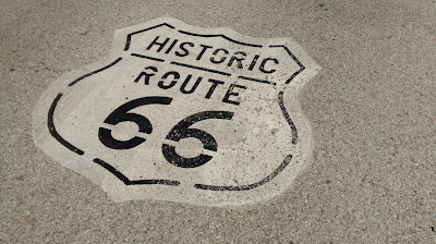
At least the Chain of Rocks Bridge was a fitting end to our trip down Route 66, though there were plenty of signs of vandalism.


The 22 degree bend in the bridge resulted from the need to keep the bridge piers on bedrock. 
Not sure what this is.  A similar nearby structure appeared to be a lighthouse to warn
of the Chain of Rocks rapids.

I rode a total of 56 miles for the day.

We found some Missouri DOT bike maps on line and have decided to alter our route through Missouri.  The maps show four categories of traffic volumes, plus those roads with at least four foot shoulders (hopefully paved).  Those route changes are now reflected on our current route map (Summer 2016).  We will go as far west as Jefferson City, then ride southeast toward the Ozarks where we will eventually reconnect with portions of the Trans America and Great Rivers South routes that we didn't ride last year.

Tuesday, July 19, 2016

Day 115: Near Staunton, IL

Lately, the heat and humidity pretty much dictate our routine.  The humidity was 94% when we awoke this morning, and within a couple of hours it was climbing to near ninety degrees.  For once, we were grateful for a light quartering headwind.  If the wind had been behind us, we likely would have cooked our brains trying to ride as far as we did.


The strategy today was to share the miles so that neither of us had to ride too long in the heat and humidity.  We ended up riding a total of 60 miles.  Alea did the first 20 miles.  I did the next 25 (all of them due south and straight as an arrow, with the exception of when I crossed to the opposite side of the freeway), and Alea rode the final 15.


We started guzzling Gatorade first thing and managed to drain our full 3 gallon water cooler before noon.  We went through 14 pounds of ice, when 10 pounds will usually last us nearly three days.

We got a bit more of the Historic Route 66 feel once we got as far south as Mount Olive, where there was a restored Shell station.


Ethyl gas...
Looks like someone forgot to do some weeding...
Roadblock!  Someone cut a corner too tight...
We are camped at Rustic Acres Campground ($26,  power, water and showers).  It is rather large, and it seems a majority of the sites are occupied by seasonal residents.  But it is well maintained.  The most important thing was that the showers have controls to adjust the water temperature, so it was possible to take a cool shower to bring our core temperatures back into a more normal range.

We usually only hang out in the cabin of our camper on rainy days, but sitting outside (even in the shade) isn't much of an option on days like this.  Fortunately we are close enough to St. Louis that we can get a few channels on the idiot box to help pass the time...