Completed Tagteam Cycling Routes


WHERE WE HAVE BEEN. The colored lines on this map represent where we have tagteam cycled since 1 Aug 2015. BLUE lines = 2015, YELLOW lines = 2016, RED lines = 2017. We will continue to update this map as we complete additional route segments (we are not done yet!).

Wednesday, May 24, 2017

Our 2017 Amended Plans

Our planned tagteam travels for this year were put on hold 15 miles south of Lake of the Woods, Oregon (on the east slope of the Cascade Mountains, due west of Klamath Falls) this past Monday, May 22nd.  

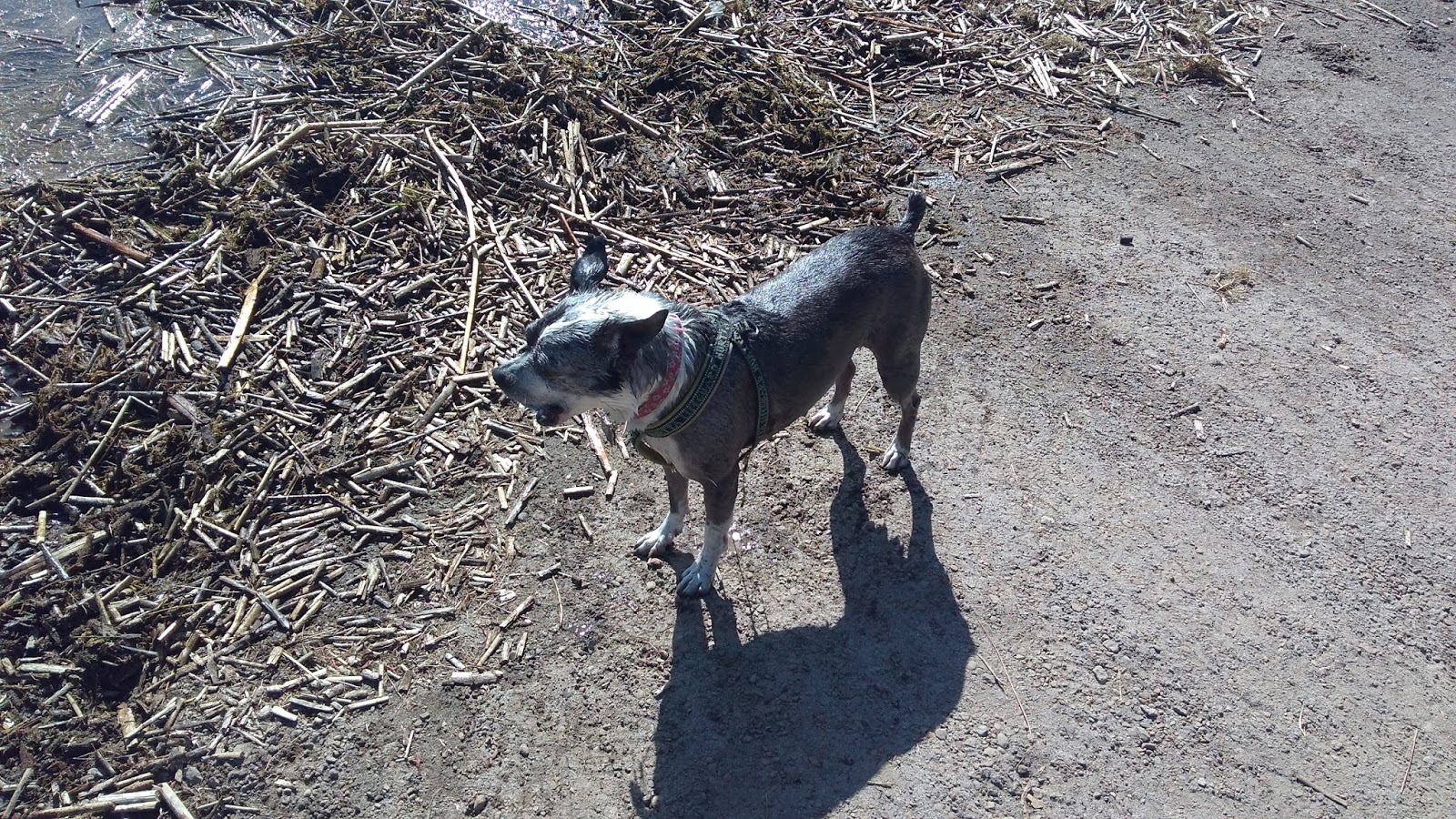
A lot of factors led us to toward this decision.  While Alea's knee is recovering, it is probably best not to continue pushing things, and instead let things heal at their own pace.  And weatherwise, thus far this year we have too often to found ourselves in the wrong place and time.  We've made it past the cold and wet, but we would be faced with a combination of potential flooding on the east slope of the Sierra Nevadas, coupled with the crush of fellow campers over the Memorial Day weekend, all while dreading the upcoming circumnavigation of Reno, NV.  This prompted a need to reflect and to adjust our travel plans.

At the end of last year, our plans were to spend more time in the west and to linger longer at the campsites we visit.  That sort of pace isn't necessarily compatible with tagteam cycling, as it potentially makes it harder to maintain a level of cycling fitness that helps to keep those cycling miles enjoyable.  So we had never quite figured out how to integrate those goals.

Another thing that we have wanted to accomplish in our travels is to attempt to determine where we might ultimately want to live once we reach true retirement age.  Taking time to investigate specific areas of interest to us while tagteaming hasn't been all that easy to do thus far, so we'll plan breaks to give us the time for that purpose.
  
So we have made the decision to no longer tagteam cycle continuously.  Instead, we will plan some enjoyable tagteam routes, interspersed with breaks for other purposes.  As such, we have the following tagteaming plans for this year:

  • In August, we are likely to cycle from Glacier National Park, Montana west through Lolo Pass, following the most arduous part of Lewis and Clark's overland journey of 1806.  But whether we opt to ride all the way out to the Pacific Ocean or instead choose a different destination is up in the air right now.
  • In September, we hope to rendezvous in the Pacific Northwest for a week or two of cycling with Travis Hodgdon, whom I had met while touring across the country 32 years ago.
  • In October, we hope to ride Skyline Drive and the Blue Ridge Parkway on our migration south for the purpose of spending the winter in Florida.
In between, we have various rendezvous planned, we will visit some places of interest where we may consider relocating in the future, I'll stop to do some genealogical research here and there, and we will look for campgrounds near some long climbs to help keep us in shape while we are "idling" between our tagteam travels.  One benefit of this approach is that it also means we won't continue to force ourselves to ride through congested urban areas, a major source of stress for us.

Our plan is to be in mostly very rural areas as much as possible.  The main impact of this decision is that we are likely to be out of cell coverage more often than not.  So blogging, social media and other internet activities are likely to fall by the wayside.  But we will attempt to post occasional updates on this blog, and repost the blog to Facebook, as we have done in the past.

Thursday, May 18, 2017

Last Blog Post

There seems to be no easy way to keep up with this blog when we lack adequate cell (and thus internet) coverage.  It has been an ongoing problem, one that we were acutely aware of in Mexico, and it persists today, except in the rare instances when we are traveling in urban areas or along interstate highway corridors (our least favorite places to ride).  

South Fork of the Umpqua River at Myrtle Creek, OR.
And the reality is that there is rarely much of anything new to share on a daily basis.  Our daily routine of plotting a course, making adjustments as needed and trying to plan for what lies a few days or weeks ahead has already been covered sufficiently in the past.  So there seems to be little benefit to justify devoting continued time and effort to the task.  I've journaled a lot in the past, and it seems my journaling days may have come to an end.  

Tuesday, May 16, 2017

Days 18 & 19: Roseburg, OR

We had decent weather for our ride to Roseburg.  It was cool and cloudy, with a following wind.  We've gained back a bit of elevation, but aside from one 2-mile-long grade, the ascents were very gradual.

Great place to park a train.
We would have liked to have pushed on after spending the night in Roseburg on Monday (Day 18), but with the chance of rain being forecast at 100% for most of the day we opted to stay put for an extra day.  On Wednesday the forecast returns to a more normal pattern for this time of year.  By Thursday we should be seeing lows in the 50s and highs in the 70s, with a slight warming trend from there.  And on Friday all the USFS campgrounds should finally be open for the season.

We managed to ride backroads and thus avoid jumping on the freeway for all but one two mile stretch.  The riding was great, with wide shoulders and/or low traffic volumes for most the day.  The exception was a five mile stretch between Drain and Yoncalla, where there were numerous logging and gravel trucks, and in many areas there was pretty much no shoulder.

We are camped at the Douglas County Fairgrounds ($25.50, power, water, adjustable showers, heated bathrooms), which is sandwiched between the freeway and a fork of the Umpqua River.  We are fortunate that we are camped right next to the Douglas County Historical and Cultural Museum, so for $5 each we were able to roam around the museum and stay dry for a couple of hours today.

We also took advantage of our layover to have our oil changed, since the Change Oil light came on while we were driving on Sunday.  It was a bit ahead of schedule, and we are a bit puzzled why that is?  But our gas mileage had climbed up to 22.6 mpg after having been below 21 mpg for most of the winter, so perhaps it is the amount of engine idling that we did during the winter that has caused the need for an oil change?

On our way to Roseburg we had been seeing a slow moving train beside us for a few hours.  As luck would have it, just north of Roseburg the train crossed our route.  I managed to cross before the train arrived, but Alea was not so lucky.  Especially since it parked at that crossing for close to a half hour.  We were glad that there is cell coverage in this area, so at least I didn't have to worry about what was keeping her.  

Monday, May 15, 2017

Days 14 - 17: Curtin, OR

We ended up spending four nights northwest of Eugene, waiting for the worst of the cold and wet weather to pass.  Eugene has a couple of movie houses that show independent films, so we took in a couple of matinee shows curing our stay in order to give us a break from rain.  

A brief sun shower...
And a rainbow.
We had hoped to visit with Alea's Aunt Hazel while we were in town, but as luck would have it, she had moved to Loveland, CO just a day or two before we got to town.  She is in her 90s, and it appears she has gone to live with a niece there.

We returned to Dexter, OR to continue our travels, eventually turning south.  It was a short day - 33 miles - of dodging occasional rain showers, and we split the mileage just about down the middle.  The last five miles of the day were on I-5, where we exited at Curtin, OR.  Once we leave here we will be following the I-5 corridor to Canyonville, OR, but it appears we will need to ride on the freeway for just two miles, along a stretch just north of Oakland.

We are camped at Pass Creek Campground ($25, power, water, adjustable showers), which is located between I-5 and a rail line.  It is a picturesque little park, and it is quieter than we imagined when we first got here. 

The moss is taking over!

Thursday, May 11, 2017

Day 13: Dexter, OR

Alea hit the road while it was still 41 degrees out, and we headed toward Hwy 58, our planned route to the Willamette Valley.  There was a fair amount of truck traffic, but generally the shoulders were sufficient. 


One of Lane County's 20 covered bridges.  This one is at Lowell, OR.
I took over when we reached Hwy 58, which meant a climb up to Willamette Pass at 5,128 feet.  Since we were already at a fairly high altitude, it was a fairly easy climb.

The descent was over 4,000 feet of nearly continuous elevation drop,  spread out over about 50 miles or so.  It would have been a screaming fast descent, if it hadn't been for a pretty good headwind blowing up the valley.  But we did make good time.  At the end of the day, I had ridden 48 miles and Alea had covered 27 miles, giving us our longest day thus far of 75 miles.

At some points along Hwy 58 the shoulder narrowed considerably, leaving little room when loaded semis went speeding by.  But there was only one truly white knuckle moment: I was flying downhill at over 30 mph through a long tunnel when I was passed by a semi pulling two trailers.  The pavement was grooved, so it was an unstable descent to begin with, but the bow wave created by the semi added considerably to that, as did the inevitable "snap" caused by the slipstream wrapping around the back of the rearmost trailer as it passed.  Fortunately, there was no uphill traffic in the tunnel, or things could have turned ugly very quickly.  It was a relief to see daylight at the far end of the tunnel.  It didn't help seeing burned out flares along the roadside every few miles, suggesting that mishaps were not that uncommon along this highway.

We left Dexter and drove to west of Eugene, OR to camp at Richardson County Park ($25, power, water, adjustable showers).  It should be raining here for much of the next week, so our intent is to hang out here and do some route planning (we found a lot of closed campgrounds when we crossed the Cascades), to figure out our best route south from here.  Once we have our route determined, we will return to Dexter and continue on from there.

We learned that May 19th is when the remainder of the USFS campgrounds open south of here, which suggests to us that we will likely follow Old Highway 99 and I-5 south as far as Canyonville, OR, where we will head back east over the Cascades toward Klamath Falls.  That route offers several conveniently located county parks spaced about 35-45 miles apart, which is our preferred riding pace.  We aren't looking forward to riding I-5, so it is possible that we might continue searching for other options for when we head out again, which will be on Sunday.

Day 12: Lava Flow Campground, Cascade Lakes, OR

By taking an eastern ring road from Tumalo State Park, we were able to get through Bend with very little hassle.  The route was hilly, but with a good shoulder the entire way, and it helped us to avoid the busy commercial parts of town.

We headed south on US 97, which we had ridden on 30 years ago on a trip from Tillamook, OR to Klamath Falls, OR.  In that span of time, it has become the preferred truck route for traveling north and south, due to the congestion found in the many cities on the I-5 corridor.  As a result, it was the least pleasant riding that we've encountered this year.


Two views of Davis Lake.  The black arm in the upper picture is the namesake
lava flow of our campground.
We opted to leave US 97 south of Sunriver, OR, choosing to head into the Cascade Lakes area.  Doing so would add 20 miles to our route, but it would bypass at least 40 miles of US 97.

But then we checked the weather forecast, which led us to check the long range forecast.  We were heading south, thinking we could find some warmer weather, but instead we were heading into a cold front that was forecast to persist for a full week: lows in the mid to upper 20s, with mostly highs in the low to high 40s.  And there were few options for public campgrounds with power along our route.


Lana had a chance to cool off in the lake.
We stopped along US 97 and did some quick route planning.  It would be wet on the west side of the Cascades, but with lows in the 40s and highs in the upper 50s.  It sounded like the preferred option.  We had a day and a half of decent riding weather left, so decided to see how close we could get to Eugene, OR in that time.

We made it as far as Lava Flow Campground (free, vault toilets) on Davis Lake, which is located at the south end of the Cascade Lakes region.  I rode 47 miles and Alea rode 19 miles of a long, hilly day.


Davis Lake, early morning.

Day 11: Tumalo State Park, OR

I hit the road while the temps were still in the 40s, which isn't my favorite riding weather for doing any kind of distance.  I rode about 16 miles before Alea took over near Smith Rock.  She did the next 21 miles and I finished up with the final 20 miles (57 miles total).

Alea with Smith Rock in the distance.
We took a longer, more scenic route to Sisters than the more direct route via Hwy 126.  We have traveled that route more than once, and while there is a good shoulder, there is also a lot of traffic.  The longer route was more relaxing, and it allowed us to get closer to Smith Rock.

We had hoped to cross the Cascades and visit Eugene, OR, but our preferred route, McKenzie Pass, is under so much snow that it may not open until July.  With that hope dashed, there was still the longer alternate route via Santiam Pass.  But after looking at weather reports and seeing that it was wetter and at least 5 degrees cooler on the west side of the mountains, we decided to head south along the eastern edge of the Cascades.

An alpaca ranch west of Terrebonne.
We set out in the morning with the intent of spending the night in Sisters, but amended our plan en route, turning south a few miles east of Sisters.  Our intent is that in September we will end our route where it intersects today's route. 

We needed to do some shopping in Bend (at the REI store), and Tumalo State Park ($21, dry camping, water available, adjustable showers) was convenient for that purpose, and the detour there only added another 10 miles or so to our day.  We have wanted to camp at Tumalo on other occasions when we have passed through this area, but this was our first visit.  And we were lucky to find a campsite, as the park was full a few hours after we arrived (on a Monday, no less!).


Views at Tumalo State Park.
By not crossing the Cascades at this time we are likely about a week ahead of schedule.  Possibly more, if high snowpack in the Sierras keeps us on the east side of the mountains.  We will figure that out as we get farther south. 

Sunday, May 7, 2017

Days 8, 9 & 10: Prineville, OR

Day 8 (Friday) was mostly a day of headwinds and ascents, so it was some fairly fatiguing riding for both of us.  Alea started off first, covering the first 13 miles or so.

Painted Gorge.
Not far west of Dayville we came to Painted Gorge, one of the unique geologic features of the area - a crack in the earth through which the south fork of the John Day River flows (the name relates to the native pictographs on the upper gorge walls).  Also in the area is Sheep Rock and the Painted Hills, both areas we've visited on multiple occasions, otherwise they would have been worth a stop on this trip.


A few miles past the Gorge it was my turn to ride the remaining 25 miles or so to Mitchell, OR.  That was our original destination for the day, at the city campground in the middle of town.  But cold weather was forecast for Day 9, and we didn't like the prospect of waiting out the weather in Mitchell.  So we pressed on, thinking we could camp at Ochoco Divide, which was another 17 miles or so farther down the road.  To help accomplish that, Alea took to the road again, riding about 7 miles and thus giving me time to recover for the upcoming climb.  Then I took over for the remainder of the day.

West of Painted Gorge.  That is Sheep Rock in the distance, just behind Alea.
It was just our luck that when we arrived at Ochoco Divide Campground we found it closed, with some sort of construction project in progress.  We were about 34 miles east of Prineville, with the nearest campground about 20 miles away.  We didn't feel we had enough left in the tank to get that far, but it was a steady descent the entire way, so I decided to see how far we could get.  We covered just short of half the distance to the next campground before the winds and my fatigue suggested it was time to call it a day.  We could have camped for free in Ochoco National Forest or stayed at a campground on Ochoco Lake, but we opted instead to drive all the way into Prineville, so that we could have power for the chilly nights that were forecast, to get caught up on shopping and to have a rest day.  We also felt we owed it ourselves to dine out, since we both had exerted significant effort over the total of 66 miles that we covered on our longest and hilliest day so far.

"Bunch of Lost Souls Just Hanging Around."
On Day 9, the forecast high was for mostly cloudy weather in the mid-50s, with a pretty good breeze coming out of the northwest.  So we made it our rest day.  We drove to Redmond, OR to do laundry, get a few groceries and stock up on dog food for Lana.  We opted to take in a late afternoon matinee at the Pine Theater in Prineville, in order to have a place to get out of the wind.

Day 10 was our chance to fill in the gap that we had skipped, from the western edge of the Ochoco National Forest to Prineville.  So we returned to where we had left off two days earlier, and I set off in thermal tights and jersey for the shallow 20 mile descent back into town.  Once again I battled the wind, but it was far less of an issue on such a short ride and being well rested.

It has warmed up a bit since yesterday, and we are looking forward to the warming trend continuing over the next several days.

We have made our first major route change for this first leg of this year's travels.  From Sisters, OR we had hoped to cross over McKenzie Pass to Eugene, which was to be our approximate ending point in September (now it will be at Sisters).  But the pass probably won't open until July, plus it is both cooler and wetter on that side of the Cascades than it is on this side.  So once we get to Sisters we will head south, returning to our originally planned route around Klamath Falls.  And the possibility remains for more changes.  As we head south we will discover how double the normal precipitation in most of the Sierra Nevadas might impact our plans.

Thursday, May 4, 2017

Day 7: Dayville, OR

The warm weather continues, so we got an early start this morning.  Add in the fact that we were following the John Day River downstream the whole way AND we had a tailwind, and you can guess that we had a pretty easy day today.  Alea again rode first, covering the first 20 miles to Clyde Holliday State Park, then I rode the final 25 to Dayville.

Strawberry Mountain.
We are camped at Southern Fork RV ($25, power, community water, showers, wifi) along the banks of the swollen South Fork of the John Day River.  It has turned into a hot day (currently 86 degrees), but we certainly aren't complaining.  This is a very small campground, with just a dozen or so sites, but there is a lot of space between campsites.  Plus there is a free book exchange that actually has some decent book titles.


Today was the first day that we could try out our new Shimano cycling sandals, which we bought on close-out in January.  We love 'em, and I suspect we will be wearing them most of the time, except when it is cold out or when rain is likely.  They are even comfortable to walk around in, which isn't something I have come to expect in a cycling shoe.

Lana's den behind the seats of our van.
This end of the John Day River valley is drier than at Prairie City, and while scenic, it isn't as spectacular.  But there is a lot of interesting geology around here, and it gets more interesting just a bit farther down the road.


Day 6: Prairie City, OR

The weather couldn't have picked a better day to turn nice.  We cycled through some of our favorite places in Oregon, and the weather was awesome - reaching into the 70s!


Heading west from Phillips Lake took us through Oregon's gold mining country, which is centered around Sumpter.  We've been to Sumpter plenty of times in the past, so we didn't bother to go a few miles off route to go into town.  But there are plenty of interesting sites in the area.  There is a steam railway, the Stump Dodger, and a huge dredge used from 1934 to 1950, which left huge piles of river rock tailings all along the rivers and streams in the area.  This area was also the backdrop for the Lee Marvin/Clint Eastwood movie Paint Your Wagon.  It is hard not to think of them singing I Was Born Under A Wand'rin' Star as we traversed the area.


The Stump Dodger.
We had three 5,000+ foot summits today.  Alea took the first and her knee did remarkably well.  I took over from there.  She rode the first 16 miles and I did 33 miles, including a great 7.5 mile downhill into Prairie City.


It is hard to beat the vista coming into Prairie City on a clear day.  The green fields, pine forests and snow capped Strawberry Mountain is a scene that is among the most beautiful in the west.  It's isolation from major population centers is the sole reason that it has remained such a scenic treasure.

An Oregon Trail memorial, with Strawberry Mountain lost in the clouds.
We camped at Depot Park Campground ($20, full hookups, heated bathrooms, $1.75 10 minute showers), which is a city park.  The site is shared with the DeWitt Museum, which is dedicated to the history of the Sumpter Valley Railroad.

Wednesday, May 3, 2017

Days 4 & 5: Union Creek Campground, OR

It was another cold morning in Baker City, OR, so we lingered at the campground until the 11 am checkout time. By then the temperature had managed to climb into the upper 40s, but it was sunny with a light breeze. We did some shopping in town, hoping it might warm up a bit while we did so. When I finally got started, the temperature had just nudged past 50 degrees, but it was clouding up and I felt a strong breeze coming from the direction that we were heading.

The Elkhorn Mountains.
It only got a few degrees warmer after that, but it never felt warmer. The overcast sky blocked most of the sun’s infra-red heat, and the swirling wind mostly came down the mountainside from snow-capped peaks, so it felt much colder than the air temperature. But I bundled sufficiently to tolerate the situation. Though it did occur to me that much of the joy of bicycle riding comes from feeling the sun’s rays on bare skin. We will both be glad when those days return to us.


Fortunately, we didn’t have far to ride - just 19 miles, which was mostly flat, save for a good climb that started a few miles before the campground.


We had known that the campground we were aiming for was only open from May to November.  It was the first of May, but we could imagine the opening being delayed until closer to the weekend. Thankfully, it wasn’t.


We are camped at Union Creek Campground ($20, power, water, flush toilets), which is run by the USFS. They are currently in the process of getting the area opened for the season, checking all the backflow preventers, cleaning up the toilets, getting debris off of the camping pads, etc. Since the water system hasn’t been fully tested, there is a posted notice stating that the water is not potable. As a result, they have cut all camping and parking fees in half. So we are staying for only $10 per night, which was a pleasant surprise.


There are plenty of downed branches, and thus plenty of wood for campfires. However, it is nearly all pine, and burnt pine bark protects the wood itself from burning. Only a very hot fire can burn completely through the bark. So we needed to scavenge around for branches that had been on the ground long enough for most of the bark to have fallen off. That gave us fires that formed a bed of coals that were hot enough to be able to burn the ample supply of available wood that still had bark on it.


We have had only roaming cell service in most of the places we’ve been in since leaving Idaho, so we rarely have access to the internet, except in the campgrounds and some towns that we visit. We suspect that will be the case in most of the rural areas that we will be traveling in throughout the west. The exceptions will likely be larger towns, and freeway and major highway corridors. It will be sometime this weekend before we find such places again.


We enjoyed the campground. There were lots of chipmunks, so Lana was pretty well entertained. We were the only campers (besides the hosts), though the campsites are large, with lots of space between them, so even if the place was packed it would have been a very pleasant place to stay.

Luckily a tree root greatly impeded Lana's progress, but not her determination

The main attraction here is Phillips Lake, which like other area reservoirs, is drawn down in anticipation of the melting snowpack from the surrounding mountains. So we’ve seen very few boats on the lake thus far.

The wildflowers are starting to bloom.  Alea and I took a hike along the shoreline to a spot where there is likely to be an explosion of wildflowers in the near future.


If the long range weather forecast from earlier in the week does not turn out to be a cruel joke being played upon us by a sadistic weatherman, when we leave here we should starting seeing daytime temperatures in the 70s for perhaps a few days in a row. Of course, that is provided that we don’t gain sufficient altitude to lose much of that warmth. The sun that we are seeing on our second day here is a hopeful sign that the forecast may be correct.


We have a new game that we play with Lana, which we call Sherlock Hound. Due to Lana’s sensory challenge (deaf in one ear, and thus can’t triangulate where sound comes from), it isn’t an uncommon occurence when playing ball with her that she can’t figure out where the ball went. So we end up playing fetch, which we don’t enjoy a fraction as much as Lana does.

But Lana is a smart dog. I forget the name of the childhood game where a person is told they are either getting warmer or colder, but this is a variation of that game. After I’ve thrown a ball and Lana has lost sight of it, we wait until she points her head in the general direction of the ball. I then say “good girl.” If she gets off track, I use the sound that I make to get her attention, then wait for her to again point her head in the correct general direction, where I again say “good girl.” The praise intensifies when she is getting really close, and at that point she nearly always finds it without any further help. She thinks it is great fun (even more fun than watching us play fetch), and is quite proud when she can finally bring the ball back to us.